Egypt Relief Map
Map of Egypt > Egypt Locator Map • Egypt Travel Tips • Egypt Relief Map • Cairo Map
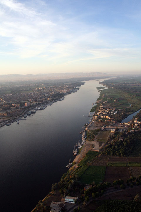 The valley of the Nile runs through the middle of Egypt, with large
expanses of desert on either side. The Nile enters the country from
Sudan, then flows eastward before flowing north to Cairo, where it enters
the Mediterranean Sea. Egypt is basically broken into two
areas: the area north of Cairo is referred to as Lower Egypt, while
the area south of Cairo is referred to as Upper Egypt.
The valley of the Nile runs through the middle of Egypt, with large
expanses of desert on either side. The Nile enters the country from
Sudan, then flows eastward before flowing north to Cairo, where it enters
the Mediterranean Sea. Egypt is basically broken into two
areas: the area north of Cairo is referred to as Lower Egypt, while
the area south of Cairo is referred to as Upper Egypt.
About 99 percent of Egypt's citizens live in the valley of the Nile, which comprises only about three percent of Egypt's total land area. However, it makes sense that the vast majority of people have settled here, as this is where most of the country's agriculture takes place.
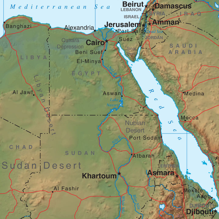
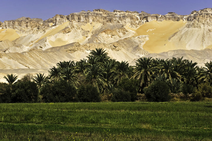 The Western Desert, sometimes also called the Libyan Desert, is located
west of the Nile, and is made up of low valleys and scarps known for
limestone. The Qattara Depression, a large area below sea level, is
located in the north of this region. Date palms grow in many of the
oases located in the desert.
The Western Desert, sometimes also called the Libyan Desert, is located
west of the Nile, and is made up of low valleys and scarps known for
limestone. The Qattara Depression, a large area below sea level, is
located in the north of this region. Date palms grow in many of the
oases located in the desert.
The Eastern Desert, located between the Nile and the Red Sea, is home to grasses, tamarisks, and mimosas, as well as desert nomads who keep sheep, goats, and camels.